GIS
TRANSPORTION STUDIES
Computer simulation software is used for planning and understanding
transportation systems and land use in modern cities. Over the
past two years Scott Branting has been working on applying similar
simulations of ancient pedestrian traffic to a reconstruction
of the street network at Kerkenes Dağ (Fig. 23).
These innovative simulations will, for the first time ever,
allow us to analyze the form of the ancient street network and
thereby learn how people in the past would have moved around
within ancient cities. Additionally, they can reveal which streets
were probably main streets that saw a great deal of traffic
of people, animals and carts, and which streets were small back
streets and alleys that saw very little traffic. They can also
yield important clues as to how the ancient population might
have made use of particular areas, compounds or buildings within
the city.
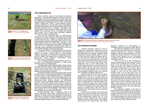
During the 2004 season we put these computer transportation
simulations of the street network at Kerkenes Dağ to the test
by excavating three test trenches (TT) across three different
streets. Each trench was laid out across the full width of a
space between two different urban blocks where it was thought
that a street had existed. TT23 (Fig. 17
and 18)
was located across a street for which computer simulations predicted
low amounts of traffic, TT24 (Fig. 19)
examined a street with a middle range amount of simulated traffic,
while TT25 was cut through the street with the highest amount
of simulated traffic volumes.
In each trench any evidence for an actual street surface was
recorded and samples of the surface itself together with the
layers above and below it were taken for micromorphological
anaylsis (Fig. 20)
in an attempt to pioneer completely new ways to analyze transportation
across ancient roadways. These samples were then sent to Dr.
Charles French at the Charles McBurney Laboratory for Geoarchaeology
at Cambridge University in England for further analysis.
The analysis at Cambridge lived up to expectations with good
correlations between the results of the computer simulations
and a number of analytical techniques on the soil samples themselves.
The transportation test trenches excavated in 2004 have, then,
revealed several important pieces of information concerning
the design and use of the street network within this ancient
city.
Firstly, we now know that well-preserved portions of unpaved
streets exist under the modern ground surface at Kerkenes Dağ.
Secondly, we have learnt a great deal more about the structure
and composition of these streets. Thirdly, we know that on at
least some of these streets we can expect to find in situ deposits
of refuse from adjacent urban blocks. Fourthly, we have seen
the first evidence that boundary walls of some urban blocks
were not constructed at the time of the foundation of the city,
suggesting that the allocation of urban space may have been
somewhat gradual. And fifthly, we know that the practice of
paving streets with stone pavement, such as was found in the
palace entrance area, was not the normal practice for street
surfacing within the city. Rather, a great number of the streets
were probably unpaved. Further information about these streets
will be gained when the results of the micromophological analysis
is complete.
This preliminary sampling of the streets at Kerkenes Dağ is
only a beginning in the development of a new suite of archaeological
transportation analysis techniques. With further work on the
street network at Kerkenes Dağ in the years to come we should
be able to turn these promising early results into entirely
new ways in which to analyze transportation and the use of space
within ancient cities, towns and regions.