 |
-
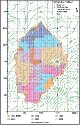
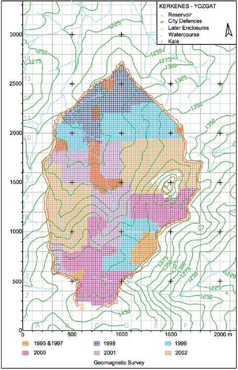
Progress map of the geomagnetic survey at Kerkenes.
By the end of 2002 the entire area of the Iron Age city had been surveyed,
omitting only the cliffs of the Kale and the Byzantine Kiremitlik at
the southern extremity. - Kerkenes'teki jeomanyetik yüzey araştırmasının ilerleyişini gösteren harita. 2002 yılının sonunda, Kale'deki kayalık alanlar ve güney uçtakı Bizans yerleşimi (Kiremitlik) dışında Demir Çağı şehrinin her yerindeki çalışmalar tamamlandı. |
|
| |
||